 The National Oceanic and Atmospheric Administration and your usual assortment of organizations keep warning that one of the dangers of climate change is the increase in wildfires. In the U.S. there was a doubling of forest fire burned area over the 1985 to 2015 period. And it will get worse into the future.
When Donald Trump re-assumes office on January 20, you can be certain that there will be a major shift in concern. Maybe they will use data from Our World in Data, for if you click on that, you will see that from 2012 to 2024, the area burnt by wildfires has remained relative constant, if not reduced over the past dozen years.
Some of this makes sense, for drier conditions mean less growth, leading to smaller wild fires. However. as we will see about Los Angeles County, the exact opposite situation prevailed. It rained so much a year ago, that there was so much dried up biomass, with seasonally natural wind conditions followed by an uncommon dry period during winter led to the worst wild fire in the region's history. The Environmental Protection Agency has reported that some areas will get more rain from global warming, so this complicates matters, but well explains what is causing record wildfire damage in Southern California.
As you must know, Lahaina, Maui was destroyed by a wildfire a couple of years ago. ABC News reported: Why climate change can't be blamed entirely for the Maui wildfires. Not to say that climate change is good for the world. Well, maybe better for places like Russia. In any case, NOAA also indicates that wildfires will not cause as much damage as many other climate change consequences, such as sea level rise and global temperatures.
 So why are those wildfires in Los Angeles County so severe this time....and why in the month of January?
 - I always thought that the Santa Ana winds blew through Southern California only during the Fall months. Historically, this is the period when wild fires plagued the region.
- A phenomena I don't quite understand is the warming of this air as it drops in altitude, when compression occurs and the mass could heat up by 18 degrees F per 0.6 mile. The humidity thereby drops, and funneling through narrow mountain passes speeds the movement. Meteorologists call this characteristic Katabic. The result is warmer, low humidity air with speeds approaching hurricane force in Los Angeles County.
- Turns out that these Santa Ana winds are prevalent from later in September into May when high pressure over the desert of the southwestern U.S. pushes through the mountain passages toward an area of lower pressure off the Pacific Coast.
- However, this time there were also very strong upper atmosphere winds compounding gusts as high as 100 MPH.
- Normally, rains come in the winter months to dampen the grounds.
- The National Oceanic and Atmospheric Administration says climate change extended the drought, making the area particularly vulnerable.
- There are five wildfires still largely uncontrolled. The Olivas fire near Oxnard and the Woodley fire have been contained.
- While all of the five deaths occurred in the Eaton fire, the Pacific Palisades fire is by far the largest.
- While lightning storms are many times credited with starting wildfires throughout the world, in the Southern California area, 95% are said to be started by humans. Not necessarily arson, but campfires, and worst of all, overheated cars.
- One other factor is that from the winter of 2024 through spring of 2024, the Los Angeles area experienced an exceptionally wet climate, leading to the growth of an extraordinary amount of new biomass in the hills and mountains. So from good can become bad.
- While there seems to be current lull in unchecked expansion, no rain expected, and winds could well pick up this weekend.
The NCAA College Football playoff resumes tonight.
First of all, none of the teams I follow made the playoff. Then, those teams I had minimal interest in lost in the subsequent games, so I have no interest in what will follow. The championship game will be played on the day Donald Trump again becomes your president, January 20, but in Atlanta, Georgia.
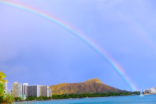
Want to see how beautiful Honolulu is? It will rain, but the vog from the Kilauea might not quite get here, so watch the SONY Open at the Waialae Country Club. I just might drive there to catch a round. But then, why pay $40 when TV well covers the game, and my drinks and hot dog would essentially be free, and not another $40 or so, in air-conditioned comfort.
-


Comments
Post a Comment